What draws people to Palo Alto is not just the ZIP code. It is the feel of its residential pockets: leafy historic streets near downtown, mid‑century enclaves with clean lines, and hillside homes that trade bustle for open space. If you are weighing where you fit, you want a clear, on‑the‑ground picture of daily life, not just a map. This guide breaks down the core neighborhood types, how people move around, where they gather, and the tradeoffs to expect so you can narrow your search with confidence. Let’s dive in.
The big picture: costs, commutes, culture
Palo Alto is a small city of about 67,600 residents with a high median household income of $231,101, according to recent federal estimates. You should expect a premium market with competitive offer dynamics and a citywide median sale price in the multi‑million range. Recent trackers have shown medians around 3.0 to 3.5 million dollars, with quick marketing times and multiple offers common in desirable pockets.
Commutes tend to be shorter than many Silicon Valley averages, with a mean travel time of about 21 to 23 minutes. A meaningful share of residents work from home, and bike commuting shows up at higher levels than most U.S. cities. The city’s long investment in bicycle infrastructure supports that culture, as highlighted by the municipal bike program pages at paloalto.gov and federal data via Census QuickFacts.
Enclaves at a glance
Professorville and Old Palo Alto
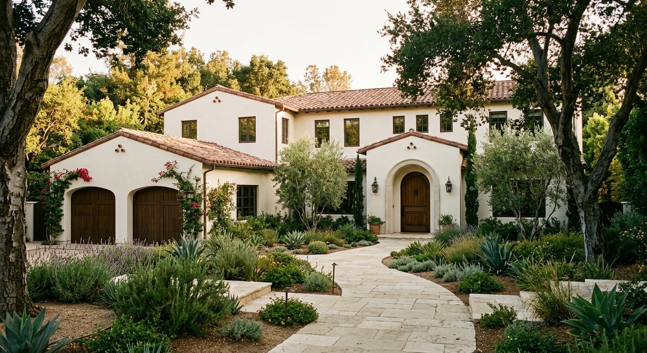
These historic districts showcase late‑19th and early‑20th‑century architecture on shaded, walkable streets close to University Avenue and Stanford. Homes often feature Shingle, Craftsman, and Colonial Revival styles, with a strong sense of place. If you want character and short walks to cafes and shops, start here. You can learn more about local historic districts on the city’s Historic Preservation page.
Crescent Park
Crescent Park reads as stately and gardened, with larger lots by Palo Alto standards and renovated period homes alongside refined rebuilds. Quiet streets and proximity to downtown create an everyday rhythm that mixes privacy with quick access to errands and dining. Families who want yard space within minutes of University Avenue often focus here.
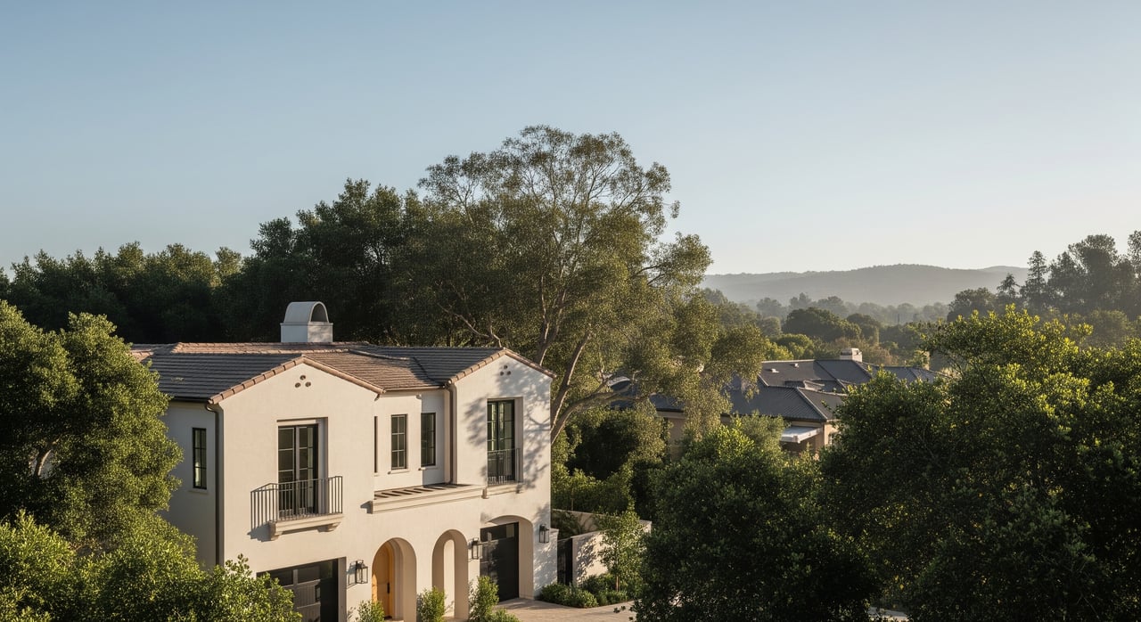
Eichler and mid‑century areas
Neighborhoods like Greenmeadow, Green Gables, Charleston Meadows, and parts of Midtown feature Joseph Eichler‑era modern homes and ranches. Expect open floor plans, indoor‑outdoor flow, and cohesive streetscapes where original character remains intact. If you appreciate clean lines and easy living, these pockets feel refreshingly simple. Local coverage has chronicled the area’s mid‑century identity and preservation interest, including features in Palo Alto Online.
Barron Park
Barron Park sits on curving streets with a quieter, slightly more rural feel and larger lots compared with many central tracts. Creeks and greenways are close, and neighborhood events help anchor a sense of community. Buyers who want calmer streets and yard space without giving up access to central Palo Alto often end up here.
Palo Alto Hills and Arastradero area
On the city’s edge, you will find larger properties, hillside views, and fast access to hiking. These homes trade immediate downtown proximity for privacy and nature. The nearby Foothills Nature Preserve is a standout amenity and is now open to non‑residents following policy changes; learn more via Friends of Foothills.
Midtown, Ventura, and South of Midtown
These central neighborhoods offer practical access to California Avenue, Research Park, and bike routes, with modestly sized lots and a more suburban feel. Many buyers see them as a balance of value, location, and day‑to‑day convenience compared with the most historic or estate‑scale tracts. The result is a comfortable, connected routine for commuting and errands.
Parks and outdoor life
You will have easy access to small neighborhood parks, community gardens, and larger preserves. Eleanor Pardee Park is a good example of a well‑used neighborhood park with open lawns and play areas, detailed on the city’s parks page. For hiking and scenery, residents head to Foothills Nature Preserve and the Baylands for birdwatching and long views. Weekends often mean a quick bike ride to a playground or a short drive to trailheads.
Shopping and dining hubs
Daily routines often center on two compact districts. University Avenue is the main street experience with restaurants, cafes, and services. California Avenue feels like a neighborhood main street with weekend farmers’ markets and a calmer vibe. The city has experimented with car‑free segments and expanded outdoor dining to keep these areas vibrant, a trend covered by local reporting on retail occupancy and street activation. For upscale retail, Stanford Shopping Center is a short drive.
Getting around town
The Palo Alto Transit Center is one of the Peninsula’s busier Caltrain hubs and connects to regional buses and Stanford’s free Marguerite shuttle. That intermodal setup supports commuters heading to the university, medical center, or jobs along the rail corridor. Local agencies are planning station and circulation improvements discussed in transportation coverage.
Biking is part of daily life for short trips, school drop‑offs, and errands. The city’s bicycle boulevards and Safe Routes to School programs make it visible, especially during school hours. You can explore current routes and programs through the city’s bike resource page, and modal data show elevated work‑from‑home and bike shares compared with many U.S. cities via DataUSA’s Palo Alto profile.
Schools and search strategy
Palo Alto Unified School District (PAUSD) is widely noted for strong academics. Third‑party rankings list PAUSD among top districts in California and report a graduation rate around 97 percent, which helps drive demand across many neighborhoods, according to Niche’s PAUSD profile. School assignment is address‑based, and buyers often weigh specific feeder patterns when choosing blocks. For the most current information, consult the district’s school finder and enrollment pages.
Match lifestyle to area
Use these quick filters to narrow your first tours:
- Want car‑light living near cafes and Stanford? Look at Professorville, Old Palo Alto, and Crescent Park. Midtown offers bike‑friendly access to California Avenue.
- Prefer space, privacy, and quick trail access? Consider Palo Alto Hills and the Arastradero area.
- Love mid‑century design and indoor‑outdoor flow? Explore Greenmeadow, Green Gables, and Charleston Meadows.
- Value quiet streets and larger lots by city standards? Put Barron Park on your list.
- Seeking balance on price, location, and commuting? Focus on Midtown, Ventura, and South of Midtown.
Practical tradeoffs
- Cost of entry. This is a premium market with tight inventory, frequent multiple offers, and medians in the multi‑million range. Be ready to move quickly on well‑located homes.
- Lot size vs. walkability. Historic districts near downtown are highly walkable with mature canopy, while larger lots and more privacy tend to sit farther from the core.
- Original character vs. new construction. Eichler and ranch tracts preserve mid‑century charm; other areas feature more extensive rebuild activity. Consider how you live day to day.
- Parking and downtown dynamics. Expect ongoing conversations around parking, car‑free segments, and activations on California Avenue and downtown, as reported by local outlets. These choices shape how streets feel at night and on weekends.
- Transit and first‑mile links. Station improvements under discussion could enhance the downtown experience over time, especially for train commuters and cyclists.
Is Palo Alto right for you?
If you want everyday convenience, a real bike culture, and access to both neighborhood parks and true open space, Palo Alto delivers. If you value walkable historic streets or clean modern lines in classic Eichler form, there is a pocket that fits. The key is matching your routine to the right enclave, then navigating a fast, competitive market with a disciplined plan. When you are ready to refine your search block by block or plan a sale that maximizes presentation and timing, connect with David Kelsey. Let’s connect for a confidential market conversation.
FAQs
Is Palo Alto walkable for daily errands?
- Northern neighborhoods near downtown and California Avenue are very walkable to cafes and shops, while many other areas pair short drives with strong bike access supported by the city’s bike network.
How accessible are parks and open space in Palo Alto?
- You will find a dense park network for play and picnics, plus larger destinations like Foothills Nature Preserve; see the city’s page for Eleanor Pardee Park and learn about Foothills through Friends of Foothills.
Will I need a car to commute from Palo Alto?
- Many residents keep cars, but Caltrain at the downtown Transit Center, the free Stanford Marguerite shuttle, and a real telework share reduce daily driving; see transportation coverage on planned station upgrades and modal data via DataUSA.
How do schools vary by neighborhood in Palo Alto?
- PAUSD serves the city, but specific elementary, middle, and high school assignments are address‑based; verify current feeders with the district’s school finder.
What price points should I expect for single‑family homes?
- Palo Alto is a premium, competitive market where recent trackers have shown medians around 3.0 to 3.5 million dollars; expect tight inventory and fast timelines on well‑located homes.
What is the average commute time for residents?
- The mean travel time is about 21 to 23 minutes, per recent federal estimates; see Census QuickFacts for context.